Sunday 30 September 2012

Across the Paddock- Clare to Robe 470 Kms

We arrive in Clare on August 20th 2013. Clare is a beautiful, green part of this country. After weeks coming across the nullarbor (the treeless plain), it is just a delight to arrive in a town like Clare. We have another of our rest days here and there will be plenty of time to visit the wineries. The Clare Valley has more than 40 cellar doors. Clare Valley’s wineries lie along a narrow 40 kilometre corridor, between Auburn and Clare. The towns are spaced closely together. Great opportunity for the riders to order their favourite wines and those bottles as souvenirs for those waiting at home for us. Most wineries will do home deliveries.

Wineries are not the only thing to do in Clare (this is starting to sound like a tourist promotion). Explore conservation parks to see giant 50,000 year old wombat fossils, stunning native wildflowers and majestic colonial homes such as Martindale Hall.

There are boutique businesses in historic bluestone buildings. Markets sell produce made using antique presses and grindstone “technology.”

There are always the pubs to check out as well.

Clare to Gawler- 95 kms (Not a huge day)
This will be the last day of the local school holidays so we better keep an eye out for harassed parents rushing home on the final day and thinking about everything that has to be done before they start back at work. Thank God it is a short day. The drivers will be unlikely to be thinking about us.

Gawler prospered early with the discovery of copper nearby at Kapunda and Burra, which resulted in Gawler becoming a resting stop to and from Adelaide. Later, it developed industries including flour milling and manufacturing steam locomotives. Not a huge amount od things to do in Gawler but a pleasant stop over.

Pretty scenery especially when the wild flowers are out.
We need to take extra water on board here as the water at our next stop is not very nice. Everyone will need to remind us before we leave the town.

Gawler to Wellington- 135 kms

Today we are skirting around the outskirts of Adelaide. Morning tea is at a place called Palmer which is just east of the Adelaide Hills. Therefore I think we may do a little climbing today.


Lunch will be at a lovely town called Murray Bridge (needless to say on the great Murray River). Murray Bridge is the fourth most populous city in South Australia after Adelaide, Mount Gambier and Whyalla. I like this town with lots of fond memories of previous holidays in this town.


Wellington is a very tiny settlement which is really nothing more than a couple of dozen houses on the banks of the Murray River. The buildings are old and nice quiet walks are available.

Wellington to Salt Creek - 100 kms
The countryside we are travelling through is usually very lush and it can be a very pleasant ride. Once we hit an area known as the Coorong, it changes again and it becomes what I think as more interesting. The environment around her is quite unique in Australia. It is a timeless, untamed wilderness with diversity that nature has provided. There is a long, narrow lagoon that runs parallel with the coastal dunes for 140km. The beach stretches 200km from Encounter Bay to Lacepede Bay, uninterrupted except when the mouth of the great Murray River opens to the sea.
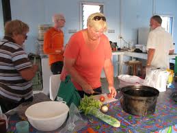
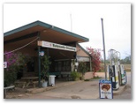
We were having difficulty locating accommodation for all of us in this area because places we had stayed in previously had closed down and new places chosen also shut down recently. Fortunately we have come across a "Roadhouse" at Salt Creek which will be able to accommodate us. We were worried we were going to have to change course and miss this area of Australia.


Salt Creek to Robe - 140 kms

Riding to another rest day at Robe. Travelling along the coast for most of today (hope the weather is being kind to us otherwise it could be pretty cold). Should have the wind up our tails today, making riding pretty easy. Mostly just one town that we go through and should hit that around lunch time. This will be Kingston. Kingston is at the southeastern end of Encounter Bay and the Coorong. The main industries are fishing, winemaking, sheep and cattle farming and recreation, the district having a large influx of tourists during holiday periods throughout the year. The northern entrance to the town is dominated by the Big Lobster, fondly named "Larry" by people in Kingston. Many great pubs, hotels, and shops can be found, and Kingston also hosts one of the best fish and chip shops in Australia. "Macs Takeaway" has twice won awards for their outstanding fish and chips (might have to be on the menu for lunch).


44 kms on from Kingston is Robe. Robe is a town and fishing port on the South East Limestone Coast of South Australia. The town's distinctive combination of historical buildings, ocean, fishing fleets, lakes and dense bush is widely appreciated. Robe lies on the southern shore of Guichen Bay, just off the Princes Highway. Robe is a very pretty town and it will be great to have a rest day here.


Thursday 27 September 2012

Western Australia- Nanutarra to Minilya - 350kms

Nanutarra to Giralia Station- 155 kms

Riding from Nanutarra directly to Minilya it is actually only 216 kms but then we would miss out on the jewel of Australia's coastline. So we have chosen to turn off at Burkett Road and head down towards the coastline. Our first night's stay will be at Giralia Station. We stayed here last year and had a great night with some of us camping and others opting to upgrade into some dongers.

We were pretty hot by the time we set up camp here last year and they have this lovely service of drinks on the homestead verandah. Very welcome luxury, a bit of a novelty having ice cold drinks. Following showers and drinks we all pulled together in the kitchen to cook up a gourmet dinner of Japanese curry! It was a nice night in comfortable surroundings and lovely people (curry was pretty good also).


Giralia to Bullara Station- 36 kms

Last year we travelled from Giralia to Coral Bay (105 kms) with a head wind nearly all the way. Everyone was exhausted by the time we got there but because it is a beautiful spot they all soon forgot their previous discomfort. We were going to repeat the experience BUT we have come up with an alternative plan.

Watching a TV travel show last weekend I discovered another station along the same road which looked just as nice as Giralia- that was Bullara Station. Bullara does sunset tours (at a price and small numbers) and also an outback tour. These looked pretty good if anyone is interested. 

Collis has phoned the owners, they were very nice sounding people and he is arranging some accommodation for us. Because of the short day and the lack of food availability, Collis & I will make a run into Exmouth to get some fresh supplies and will add another meal to the itinerary.


We should be able to get some snorkelling in here as well.

Bullara Station to Coral Bay- 60 kms (Another short day)

Then onto to Coral Bay. I must say this was my favourite spot last year, so next year we had added an extra days rest here. But now we have brought it back down to 1 rest day due to our change in plans. We should arrive early in the day so we will still have nearly 2 full days here to enjoy the biggest reef, closest to the land in Australia. At Coral Bay we upgrade into the Backpackers accommodation with a pool and dorm rooms. Not a bad spot all in all and a couple of nice restaurants in close proximity.


Saturday 22 September 2012

Outback Queensland- Clermont to Charters Towers 370 kms

 Clermont to Belyando Crossing is 170 kms. BIG DAY!!

Collis and I stopped at a roadside fruit stall on our way out of Townsville and we were told to try the steak sandwich at Belyando Crossing. We were told they were the best in Australia and they were to die for!! As lovers of a decent steak sandwich and looking out for the best steak for one of our riders we had to try it. The experience was so bad that I got the giggles watching Collis trying to finish it (he hates to see food wasted). I had to walk out of the cafeteria/restaurant- I thought the fruit stall holder must have been talking literally.


Since then I have been worried about what will be available for the riders to eat. They sold other things other than steak sandwiches so I thought it couldn't be all bad. Looks like I may have been wrong by some excerpts from a web site called "Caravan Park Photos" which weren't very complimentary.


I think we may have a BBQ that night, due to the uncertainty of the riders getting a large nourishing meal. We planned on a BBQ a couple of nights previously at Emerald to celebrate our half way mark but this may be a better place to celebrate the half way mark, just because.


The people working there were a very young bunch but very friendly so Collis & I decided it wasn't too bad with the camping area looking dry (with very little grass) but it was a large area with power and the toilets looked clean. The cabin accommodation didn't look fantastic so I wouldn't advise people upgrading. According to the previous website we may need to remind the riders to have a supply of ear plugs and not to camp near the car park as apparently the bar can get lively on some nights.

Cycle across oz has very little choice as to where we lay our heads especially after such a long day, so hopefully the pub will be quiet for us that night. It's a bit dangerous for us to take off at 3.15 am and we don't encourage any of the riders to leave before sun up.

Belando Crossing to Bush Camp 130 kms approximately
Not such a long day but you won't want to be too tired either. Small gradual climb from here but mostly the road looks straight and mostly flat. Very lonely road with very little traffic and not many buildings (if any). A few mining properties around here that provides the mining truck traffic and entrances that ensure you don't feel welcome to visit. Lots of road kill along this road so it should be a busy day spotting wild life that hasn't been run over.
We have picked out a nice area for lunch at the Cape River rest area, hoping there is plenty of water in the river. Bush camp area looks pretty good on the corner of a side road with plenty of wood for the fire and flat areas. No shower this night.


Bush Camp to Charters Towers 70 kms


Nice short day today and we should be arriving at our caravan park before lunch if all goes well. It is unlikely that we will stop for morning tea today. Drink stops will happen but it takes us much longer to pack up and clean the camping area after a bush camp so we probably won't catch the cyclists before town.

Michael and Anna will be driving also so they can provide water top ups as needed. The main thing we noticed when we drove down this way were the number of dead but also live snakes and lizards out on the road. We will have to keep an eye out for them while camping especially first thing in the morning- best to stay in bed until first light so you can see what you are stepping on. Don't mean to scare anyone as with all our travels and camping trips we have never had snakes bothering us at all.

Charters Towers is a very historic town and worth the time to tour on the rest day. Collis is hoping he may run into Bob Kater (some politician) in the main street as this is his home town. We should hear him before we see him although if he is wearing his customary 10 gallon hat then we may see him first.


Friday 14 September 2012

Halls Creek to Fitzroy Crossing 290 kms


Warmun to Halls Creek is 165 kms of undulating terrain with some hilly sections. The scenery is grasslands & light scrub with the Bungle Bungles in the distance.  We will cross lots of little rivers where we can cool off from time to time. 
Halls Creek is a newish town (there is old Halls Creek) with a large aboriginal settlement. Not the prettiest town around with bars on most windows. Old Halls Creek, in 1855 was the site of WA's first gold rush. The town was relocated in 1955 to less rugged terrain & to bring it closer to The Great Northern Hwy.
Their sense of humour

Main Street

Old Halls Creek- worth a look but the road out is pretty rough.

This will then lead into the next 290 kms.
Leaving Halls Creek it is pretty flat but at about the 50 km mark we start to climb, through some rocky outcrops. We will have morning tea at the Laugher River parking bay at 52 kms.  After morning tea we cross over the Laura River up to a lookout at 90 kms. Brief stop here before heading down to Mary's pool for lunch. Should be water for everyone to cool down in.
Mary's Pool over the Margaret River

This is a very popular rest area and people stay for up to a week here but we have to move on otherwise the next day would be just too long. 40 kms down the road from Mary's Pool is Mosquito Creek. It looks to have a bridge over it and hopefully we will be able to find a nice camping area close by. We will have to watch out for salt water crocs as the creek appears to be tidal. 


Mosquito creek at low tide.
The next 140 kms to Fitzroy Crossing

9 kms down the road we hit Landrigan Creek. Still doing some climbing as we will have morning tea at another lookout, Ngumban Cliff.
Painting for sale, but not by us.
We continue to cross over some small creeks and hopefully they will have some water in them. Just after Gap Creek is a parking bay where we will have lunch. Afternoon tea will be at another parking bay just past the Pillara Mine turnoff. All day we will be passing alot of turnoffs to different aboriginal communities- some of them are Moongardie, Yiyili, Mingalkala and Maladja Communities. The stations we pass by are Louisa Downs Station, Mt Pierre Station & Lamboo Station.

Fitzroy Crossing with an approximate population of 920 people is located near a suitable crossing of the Fitzroy River Just out of town are the stunning orange cliffs of Geikie Gorge.


Friday 7 September 2012

Whim Creek Closed.

Whim Creek Hotel has closed, it has been confirmed. It may not be a big deal as the reception we got from them last year wasn't the most welcoming. From what I can gather on the internet, all that is left at the pub is a cockatoo. Don't think we will be allowed to camp there so we are looking for a new sight around that area.

27 kms on from Whim Creek is a rest area over the Sherlock River. We passed over many rivers last year but I'm not sure which one this was. Even one river had black swans on it and I think this may have been the Sherlock.

I think this may have been the river!!
Or is it this one??
A picture from the internet of the Sherlock campsite looks OK!


Or our other choice could be 26 kms before Whim Creek at the West Peawah rest area. This has some beautiful trees but apparently can be very popular with caravans.

If we do the Peawah River bushcamp, the kilometres that day would be around 90 kms with the next day being around 137 kms. Then if stopping at the Sherlock River would be 137 kms from Sth Hedland then the next day we would do 90 kms the following day leading to Point Samson and our first rest day on this leg (after 6 days of long days riding in the heat).
What does everyone think, especially those that have done this leg themselves.